1870s
A Store Becomes A Townsite
Early settlers arrived from Denton County, and Sam Smith opened a grocery store that became one of the anchors of the growing community.
Scanned from Sunset?
Start a grill pickup order or explore the Sunset Pulse map.
Find Faster. Swap Easier. Act With Confidence.
Live Search, Adjustable Algorithm
Selling land? Use regional filters to find viable opportunities faster.
Maps, Viewer, Neighborhood Context
Use spatial search and immersive property views to understand location context before you commit.
Jamie Summarizes What Matters
Jamie turns scattered market inputs into one usable summary with key details and actionable next steps.
TAH Animal Of The Day
2026-10-07 / catalogue_of_life_v3_6
Asio
Rank
genus
Shard
#3
Mostly not globally endangered, but local trends vary
Unknown at genus level
Asio is a genus-level record; population estimates vary by species and region.
Taxonomy from Catalogue of Life TAH; conservation summary curated for the genus/group level.
Sunset, Texas
Sunset sits in southern Montague County near State Highway 101 and Farm Road 1749. Its story runs through frontier settlement, a post office name change, railroad growth, and the farm economy that shaped much of North Texas.
A surveying error once placed Sunset in Wise County, but a 1900 lawsuit awarded the land, including the townsite, to Montague County. That mix of local identity, boundary history, and working-land heritage is part of the place Sunset Pulse calls home.
Early settlers arrived from Denton County, and Sam Smith opened a grocery store that became one of the anchors of the growing community.
Smith applied for a post office under the name Smithville. Because that name was already taken, postal authorities suggested Sunset.
The Fort Worth and Denver Railway came through the community, drawing nearby residents toward the tracks. Sunset voted to incorporate on July 26, 1884.
By 1900, Sunset had grown past 600 residents and supported cotton gins, banks, a school, churches, a gristmill, a canning factory, and the Sunset Signal newspaper.
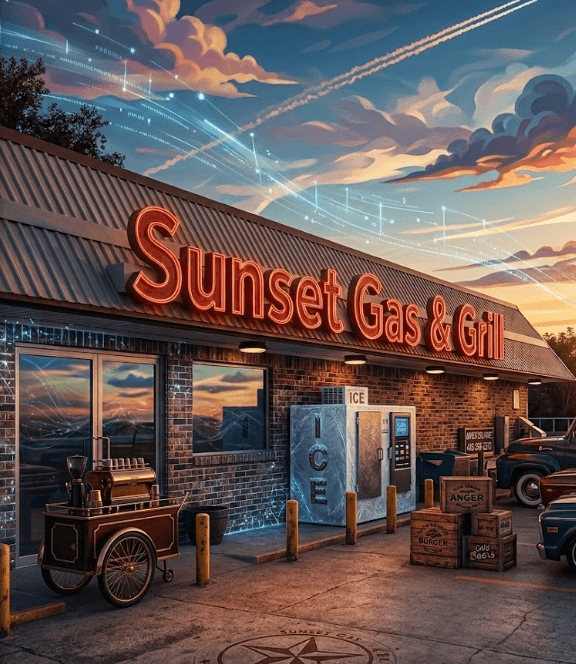
Valero lists Sunset Gas & Grill at this address as a station with fuel and a quick-service restaurant. Sunset’s documented town history includes an earlier grocery store, railroad service, and farm-market institutions; the sources do not establish a historical connection between those businesses and today’s station.
Atlas Pulse
72%Sunset townsite, southern Montague County is currently strongest against texas_place_history.tah.
Sunset Texas history Montague County railroad post office
Identify strong rental opportunities. Manage bookmarks and coordinate directly with property managers.
Browse PropertiesOnboard your properties to the platform for better market exposure and tenant lead generation.
List PropertyCore Workflow
ENTERPRISE INFRASTRUCTURE & PROPERTY DATA
Built on Next.js 14 utilizing React Server Components (RSC) and Partial Prerendering (PPR) for extreme performance. Critical page shells mount instantly via static delivery, while dynamic Streaming Suspense Pockets hydrate data-heavy segments concurrently.
A dual-engine data layer combining Supabase (PostgreSQL) for relational integrity and auth with MongoDB for flexible property metadata. We utilize Real-time Broadcasts for live inventory updates and tag-based revalidation for high-performance caching.
"Architecture scales dynamically based on request volume, keeping property search fast and reliable."
Our core reasoning engine, Jamie, synthesizes raw market data into actionable intelligence. By processing distributed signals—from RSS feeds to TAH cartridges—Jamie provides risk assessments, neighborhood context, and strategic recommendations.
Utilizing local Ollama (Gemma-2) and remote LLM orchestration, we enhance standard RSS feeds with linguistic purification, removing noise and extracting high-signal market events.
The platform interface can adapt visual styling based on selected modes and content context, keeping the experience consistent across pages.
A high-performance geospatial core utilizing Three.js and React-Three-Fiber to render a navigable, high-fidelity globe for regional property distribution.
An immersive 3D interface for inspecting property context, neighborhood momentum, and spatial tradeoffs in a unified, walkable virtual environment.
Optimized rendering pipeline for high-fidelity property evaluation, ensuring complex architectural data is delivered with zero latency across all viewports.
The VibeEngine serves as the adaptive styling backbone for the entire monorepo. Using 16-character PulseHash signatures, it enforces deterministic aesthetic parity across all workspace applications and distributed tenant sites, ensuring visual states stay synchronized from frontend React components to backend render pipelines.
Current listings from the regional MLS feed
[ LIVE ] - Regional IDX feed